CANADIAN COUNTY Red Bluff Resources Operating Llc Mississippian: Oil 300 Gas 1309 Water 450 Pump 24 13N 6W Carpenter 1306 3-24mh, September 08, 2019 HH, OIL, TD: 13129 ft Lat: 35.58073, Long: -97.79478 API: 35017254880000 DEWEY COUNTY Tapstone Energy Llc Mississippian (less Up Chester): Oil 412 Gas 1388 Water 734 Flow 32 20N 17W Howard 5-19-17 3h, January 10, 2019 HH, OIL, TD: 15950 ft Lat: …
April 2021 archive
Permits to drill for April 30, 2021
Blaine County COLUMBINE 22_15_10-15N-10W #2HXX, March 11 2021 27 15N 10W SWNWNWNE API: 01124258 Lat: 35.75321555489661, Long: -98.25089696734857 DEVON ENERGY PRODUCTION CO LP MU, AM, 26975 ft, MISSISSIPPIAN(9555), MISSISSIPPI(9555), WOODFORD(11010) Blaine County COLUMBINE 22_15_10-15N-10W #3HXX, March 11 2021 27 15N 10W SWNWNWNE API: 01124259 Lat: 35.7532155617339, Long: -98.25079586565268 DEVON ENERGY PRODUCTION CO LP MU, AM, 26812 ft, …
Completion reports for April 29, 2021
MAJOR COUNTY Red Bluff Resources Operating Llc Meramec: Oil 51 Gas 265 Water 385 Pump 8 21N 12W Cooper 2112 7-5mh, April 09, 2019 HH, OIL, TD: 13081 ft Lat: 36.31777, Long: -98.49910 API: 35093251920000 MCCLAIN COUNTY Daylight Petroleum Llc Viola(7840): Oil 8 Gas 51 Water 129 Flow 35 5N 3W Atlas 35-5n-3w, October 15, 2019 SH, OIL, TD: 9480 ft Lat: 34.86067, Long: -97.49333 API: 35087222650001
Permits to drill for April 29, 2021
Canadian County PETERS #1407 4H-15X, April 14 2021 15 14N 7W NENENENW API: 01725670 Lat: 35.69596750832907, Long: -97.93339233116966 OVINTIV MID-CONTINENT INC. MU, AM, 19021 ft, MISSISSIPPIAN(8401), WOODFORD(8851) Canadian County PETERS #1407 3H-15X, April 14 2021 15 14N 7W NENENENW API: 01725669 Lat: 35.695967513834674, Long: -97.93347652232708 OVINTIV MID-CONTINENT INC. MU, AM, 18950 ft, MISSISSIPPIAN(8406), WOODFORD(8856) Canadian County PETERS …
Continental increases Bakken operations and those in the Powder River Basin
Continental Resources apparently likes the oil prices in recent weeks as the Oklahoma City-based shale oil producer indicated it plans on increased drilling operations in North Dakota’s Bakken shale field where founder Harold Hamm pioneered some of the state’s drilling operations. In a conference with investors, Hamm said nearly 70% of the company’s well …
US crude oil reaches nearly $65 a barrel
Crude oil prices made another big jump in Thursday’s trading as US prices reached nearly $65 a barrel following a gain of 1.65%. West Texas Intermediate crude for May delivery increased $1.07 to settle at $64.93 a barrel in trading on the NYMEX. Global benchmark Brent crude for May delivery gained 1.85% on a …
Reports indicate Chesapeake might sell South Texas assets
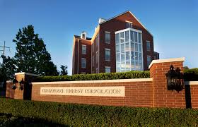
A report by Reuters indicated that Oklahoma City-based Chesapeake Energy Corporation might be attempting to sell its South Texas assets. The wire service report indicated the oil-producing assets, which include more than 220,000 acres in the Eagle Ford shale basin could bring nearly $2 billion for the company. The assets produced 84,000 barrels of …
Flowserve plant closing in Tulsa
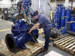
Texas-based Flowserve Corporation revealed this week its intention to close its Tulsa plant, a move that will affect 52 employees. Flowserve, a multinational corporation and one of the largest suppliers of industrial and environmental machinery such as pumps, valves to the power, oil, gas and chemical industries notified the Oklahoma Office of Workforce Development. …
Completion reports for April 23, 2021
CANADIAN COUNTY Camino Natural Resources Llc Mississippian: Oil 178 Gas 864 Water 2051 Flow 23 11N 7W Turner Falls 23-14-1mxh, October 02, 2020 HH, OIL, TD: 18133 ft Lat: 35.41288, Long: -97.91671 API: 35017256230001 Urban Oil & Gas Group Llc 29 13N 8W Calumet Cottage Grove Unit (Clark 1) 1-29, March 11, 2021 SH, INJ, TD: 9350 ft Lat: 35.56758, Long: -98.07661 …
Permits to drill for April 23, 2021
Harper County MYRTLE B #3-6, April 23 2021 06 26N 24W W2NENENE API: 05922548 Lat: 36.76742970576456, Long: -99.82002235368283 LATIGO OIL AND GAS INC SH, RC, 6685 ft, TONKAWA(5337), CHEROKEE(6460) Noble County FRANK #4, April 22 2021 25 21N 2E NWSESENW API: 10324771 Lat: 36.2692446999215, Long: -97.04228865160293 O G P OPERATING INC SH, DR, 560 ft, HOTSON(540) Oklahoma …


