
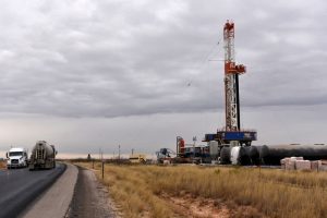
One of Oklahoma’s major oil and gas producers is slowly expanding its exploration efforts in the STACK and SCOOP plays.
Continental Resources recently received a drilling permit for Blaine County, one of the three principal counties that make up the STACK.
It intends to drill the SLAGELL #2-20-29-32XHM, at a site southeast of Thomas and several miles northwest of Geary. The legal site is 17 14N 13W.
Continental also received a drilling permit in the SCOOP. It intends to drill in Grady County at 32 6N 6W, the legal site for the LINTON #2-32-5XHM, which is southeast of Chickasha and due east of Ninnekah. Continental has a long history of drilling in the region east of Chickasha.
Kaiser-Francis Oil Company received a Caddo County drilling permit for the CART AND GUNTER 17-9-11 #1H, which has a legal site of 20 9N 11W southwest of Binger.
Trans Pacific Oil Corporation has an Alfalfa County permit to drill the KAREN A #1-29, where the legal site is 29 29N 12W. It is about 3 miles south of the state line and 5 miles south of Kiowa, Kansas.
Duncan’s Mack Energy Co. plans to drill the SW WILDCAT JIM DEESE UNIT #8-1-I, in Carter County at
12 2S 3W or about 3 miles southeast of Raliff City.
Redland Resources LLC has a permit to drill the HILLTOP #1-27, located at 27 3N 9W in Comanche County. The site is southeast of the town of Sterling.
A Creek County permit was received by Rush Creek Operating LL for the GUNSLINGER #32-1, located at 32 15N 9E or about 5 miles south of Bristow.
Red Rocks Oil & Gas Operating LLC received a McClain County permit for the ELIZABETH NORVILL #2, northeast of Lindsay at
29 5N 4W.