
Rain this week in Oklahoma could mean big steps in helping the state’s firefighters dealing with wildfires. But Monday’s fire update from the Oklahoma Forestry Services also cautioned firefighters.
“Firefighters take note: Isolated storms in the vicinity of going wildfires may support extreme fire behavior and dangerous
firefighting conditions.”
It could mean the approaching storms and their windy conditions might actually make the fires more dangerous and destructive. A few isolated storms may develop in western Oklahoma, said the Forestry Services, presenting potential for lightning ignitions and wildfires impacted by outflow winds driving erratic fire behavior.
On Monday, the Services said the hot, dry and conditions were expected to “spur high to very-high fire danger indices across Oklahoma.”
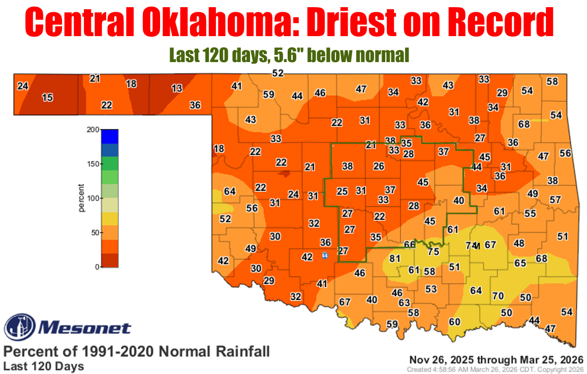
The driest conditions were in the western, central and north-central areas of the state. Firefighters were told that the cold front entering the state on Tuesday would likely stalling supporting isolated storm development east of the dryline in western Oklahoma.
Some large fires were still burning across the state with the largest near McAlester.
Large/Significant Fire Activity: (>100 Acres Timber or >300 Acres Grass/Brush)
• River Ranch Fire (Adair County) – 160 Acres / 50% Contained
• Big Toe Fire (Pittsburg County) – 1,208 Acres / 90% Contained
• Coleman Hollow Fire (Mayes County) – 104 Acres / 90% Contained
• Buffalo Pasture Fire (Adair County) – 406 Acres / 75% Contained
• Old Kentucky Fire (Sequoyah County) – 712 Acres / 85% Contained
Outlook: Broader rain chances develop Wednesday and Wednesday evening, again the highest probability of wetting
amounts resides east of I-35. Amount and duration of rainfall Tuesday-Wednesday will be critical for assessing wildfire
potential in western Oklahoma on Thursday/Friday as warm/wind/dry conditions rapidly return across the west.