
Northwest Oklahoma wildfire chances increase this week
The latest wildfire update from the Oklahoma Forestry Division indicated growing chances of more wildfires in the northwest part of the state.
Statewide Discussion:
Rainfall Friday/Saturday provided wetting rainfall across most of the southern half of Oklahoma as well as the northern tier of counties tempering composite fuel moisture in some areas while the Oklahoma Panhandle and a broad swath north of I-40 did not receive that benefit.
Drying conditions early this week will rapidly bring fuels back to availability ahead of strong fire weather Tuesday through Thursday. Critical fire weather will develop Tuesday in the Panhandle/Northwest/West in areas where little rainfall occurred. This area aligns with exceptional fuel loading on the landscape. Wednesday, will bring wider spread dry air prompting expectation for a broader area of concern. While Tuesday is expected to be the day of highest concern, fire danger persists through the work week in Oklahoma.
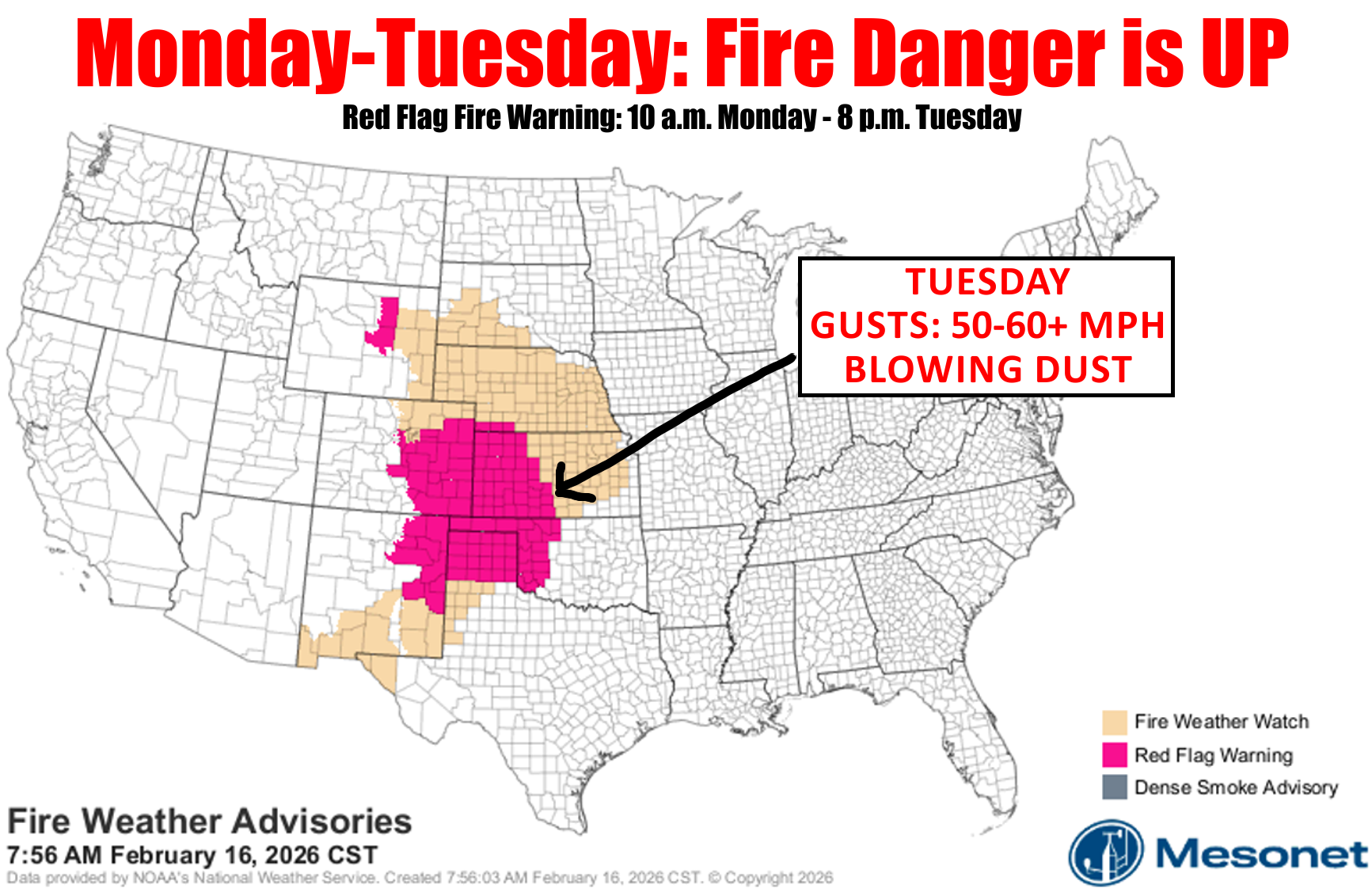
Tuesday: A dryline will push across the Panhandle and into
western Oklahoma prompting a Red Flag Warning with very warm temperatures in the mid-70°s to mid-80°s coupled with relative humidity values in the teens.
Skycover (clouds & dust) may offer some fuel shading although fine-dead fuels will be very receptive at 3-4%. Southwest winds will be strong, sustained 30-35 mph with some gusts possibly 60+ mph driving potential for rapid rates of fire spread – potentially as fast as 5 mph on fully established wildfires in the Warned Area.
Windspeeds will negate potential for aviation support. While no significant wind shift is anticipated, linear fire progression in the high fuel loading present in the Panhandle/Northwest will support moderate potential for significant fire occurrence (fires exceeding 5,000 acres) given fire spread potential and an extended burning period with poor overnight moisture recovery. East of the dryline, cloud cover and relative humidity values >30% will offer some mitigation, although any established fire will have potential to exhibit moderate to rapid rates of fire spread and suppression efforts will be complicated in areas where rainfall has softened soils limiting engine/equipment access.
Outlook: Much drier air overspreads Oklahoma on Wednesday
with most locations expected to observe afternoon relative
humidity values 10-21% accelerating fuels drying with continued
warm temperatures. Southwest winds will be strongest in the
Panhandle and western one-third of the state holding potential
for large fire occurrence firmly in place across a broad area
generally along and north of I-44. High to very-high fire danger
indices on Thursday will again be a concern with that dry air in
place and breezy conditions.
OFS Mobilization: (in place Monday afternoon)
Woodward – Suppression Group (Engines / Dozers / Overhead)
Guymon – Suppression Group (Engines / Dozers / Overhead)