
There’s a good reason why some of your garden or flowers are drying up so quickly after last week’s rainfall in the state.
Dry conditions are quickly returning and they have the attention of Oklahoma Mesonet Climatologist Gary McManus.
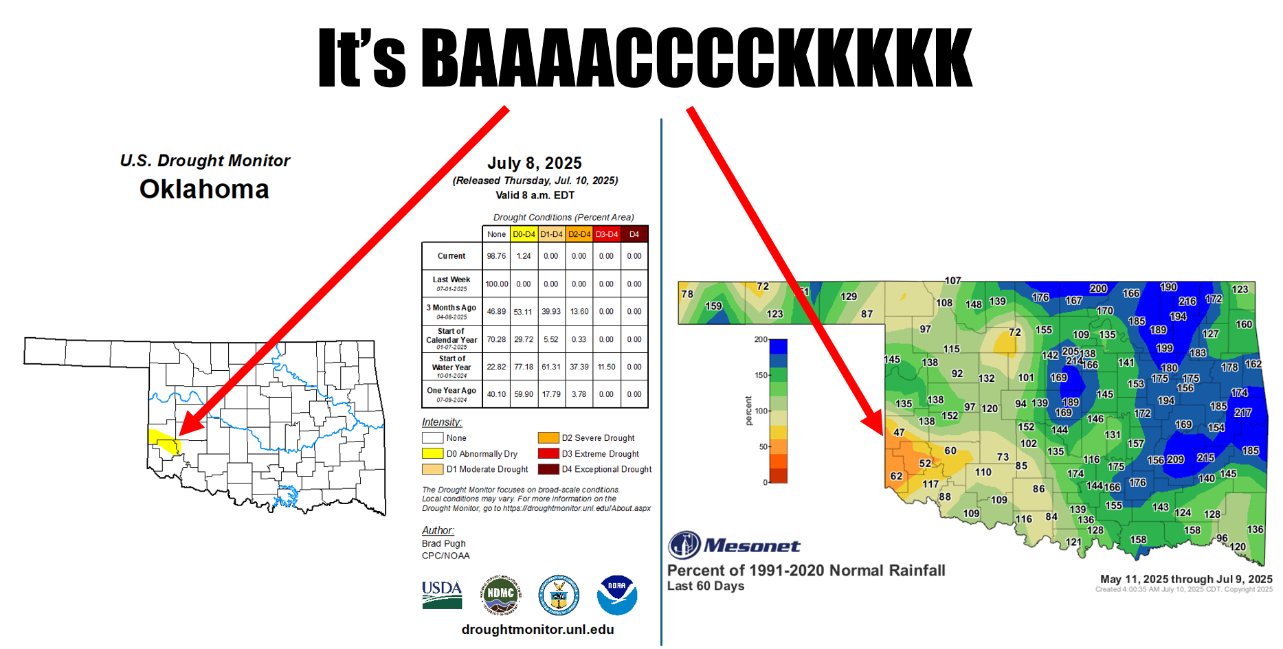
*This is a gentle reminder that D0 (i.e., that yellow color on the Drought Monitor map) isn’t drought, it signifies “abnormally dry conditions,” for areas either possibly entering or exiting drought. D1 is where drought starts on their intensity scale,” he wrote this week.
As he put it, “that month was great whilst it lasted.”
“Since being color free for the first time since June 2019 back on June 10 (and drought free since June 3), things have continued to dry out across SW OK.”
Just as Thursday was expected to be the hottest day so far this summer in the state, McManus suggests the heat will be with us for some time but there could also be a quick reversal this weekend in Oklahoma.
“A stalled front this weekend is gonna be the focus for some possible heavy rains, enough so that we’re in the “slight” flood risk area in the WPC’s excessive rain risk map for this weekend.”