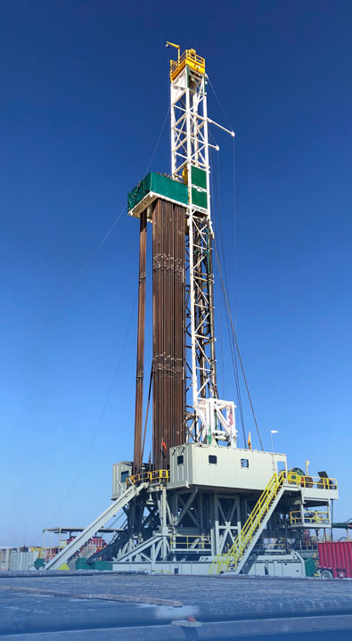
Southeastern Oklahoma’s Pittsburg County is the site of more big natural gas wells, the latest by Trinity Operating USG LLC, which filed reports on wells completed in May of 2022.
Trinity, a Houston-based company with drilling operations in Oklahoma, Texas and Louisiana, produced two natural gas wells on a single pad and combined production of more than 44,000 Mcf of natural gas.
The Payden 3-24/13/12h, one of two wells drilled at 24 5N 13E, a site located a few miles southwest of McAlester, produced 27,699 Mcf of natural gas from the Woodford formation. The drilled depth was 21,837 while the true vertical depth was listed at 8,744 feet according to the completion report. The well had a November 2021 spud date.
The Payden 2-24/13/12h, drilled on the same pad and completed in May 2022, produced 16,359 Mcf of natural gas from a drilled depth of 21,485 feet and a true vertical depth of 8,744 feet. The completion report showed a spud in November of 2021.
Camino Natural Resources LLC of Denver, Colorado reported the completion of a Grady County well with natural gas production of 22,120 Mcf from the Woodford formation. Drilled depth for the Wagner 0607 15-22-1wxh, located at the southern edge of the city of Chickasha, (10 6N 7W) was 24,890 feet. The well, completed in January of 2023, had a true vertical depth of 17,166, had a July 2022 spud date.
Another Grady County well, drilled by Marathon Oil Company of Houston, produced 8,328 Mcf of natural gas in addition to 14 barrels of oil a day from the Woodford formation. Completed in May of 2022, the Kem Ranch 0406 2-24-25wxh, had a drilled depth of 26,086 feet and a true vertical depth of 15,242 feet. The well, located several miles south of the town of Alex, (24 4N 6W ) had a spud date of June 2021 according to the completion report.
More drilling operations are coming in Oklahoma’s STACK play as indicated by some of the latest permits to drill issued by the Corporation Commission.
Crawley Petroleum Corporation, a nearly 50-year old Oklahoma City energy company, with a history of conservative growth and expansion, plans to continue its exploration efforts in the STACK. It received a permit for the SHARON #2-32-5MHX, a site about four miles northeast of Canton in Blaine County. It plans its exploration in the Mississippian formation.
Two Canadian County wells to be drilled on the same pad were permitted for Citizen Energy III LLC of Tulsa. The WINNINGHAM #1H-5-8-17 and the WINNINGHAM #1H-4-9-16 are to be drilled at a site about 4 miles east of the city of Hinton and exploration will be in the Mississippian.
A Kingfisher County well, the HOBBS C #1, will be drilled at a site about four miles west of Drover. Blake Production Company Inc. of Oklahoma City received the permit.
One of its exploration sites, according to the Blake Production website, is its 8,100 acre Hennessey Unit. The Oswego and Mississippian Limestones are the primary formations of interest and are located in Kingfisher County, OK.
Here is a list of even more STACK wells to be drilled:
Blaine County
SHARON #2-32-5MHX, March 23 2023
31 19N 12W NWNENENE API: 01124357
Lat: 36.08596759084403, Long: -98.51392571098108
CRAWLEY PETROLEUM CORPORATION
HH, AM, 19200 ft, MISSISSIPPIAN(9300)
Canadian County
LION 16_9_4-14N-9W #2HXX, March 24 2023
16 14N 9W NWSWSWNE API: 01725938
Lat: 35.69070593644724, Long: -98.16259121814748
DEVON ENERGY PRODUCTION CO LP
MU, DR, 23101 ft, MISSISSIPPIAN(9524), WOODFORD(10973)
Canadian County
LION 16_9_4-14N-9W #3HXX, March 24 2023
16 14N 9W NWSWSWNE API: 01725939
Lat: 35.69070594355201, Long: -98.16249019539414
DEVON ENERGY PRODUCTION CO LP
MU, DR, 23387 ft, MISSISSIPPIAN(9524), WOODFORD(10973)
Canadian County
LION 16_9_4-14N-9W #4HXX, March 24 2023
16 14N 9W NWSWSWNE API: 01725940
Lat: 35.69070595057202, Long: -98.1623891726408
DEVON ENERGY PRODUCTION CO LP
MU, DR, 22951 ft, MISSISSIPPIAN(9524), WOODFORD(10973)
Canadian County
LION 16_9_4-14N-9W #5HXX, March 24 2023
16 14N 9W NWSWSWNE API: 01725941
Lat: 35.69070595750722, Long: -98.16228814988744
DEVON ENERGY PRODUCTION CO LP
MU, DR, 22988 ft, MISSISSIPPIAN(9524)


