


No one can have more fun with the weather than Gary McManus, State Climatologist with the Oklahoma Mesonet and the Oklahoma Climatological Survey.
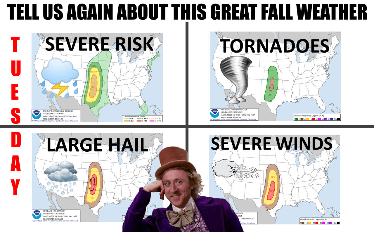
Check out his Tuesday warning about the possibility—slight possibility— of a tornado or two along with other kinds of severe weather in the state.
In his Monday weather alert, he teased us with the fact that Oklahoma has had 28 tornadoes this month, the highest total in the state since someone started keeping records about such things way back in 1895.
Then he hit us with what could happen.
“It’s the “normal” October setup we’ve seen before with a strong upper-level system dragging a front through the state tomorrow, with a dryline out ahead of the front. We’ll have strong southerly winds pumping warm air and Gulf moisture ahead of the front, and storms could fire in the afternoon. As those storms initially go up, they might stay discrete and begin rotating, which would
produce the tornado threat you see on the SPC maps…5% is pretty low, but it’s not zero, of course, so a few tornadoes possible in addition to a more robust risk of some fairly large hail. As the front catches up to the dryline, the storms could form into more of a squall line as they sweep east, creating more of a straight-line wind threat. However, the tornado threat will continue, but much lower. Those brief/small (usually) QLCS tornadoes at the front of the line of storms are something to watch for.”
Having pointed out what McManus had to offer, it’s probably wise for any energy industry worker to stay alert on Tuesday, right?