


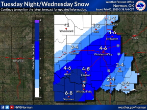
If the weather forecasters are accurate, much of Oklahoma could get snow this week. Maybe four to six inches. So energy crews from those working on wind farms to oil and gas rigs and power crews are digging out their cold weather gear as “blue norther” clouds started gathering on Monday.
Gary McManus, the State Climatologist with the Oklahoma Mesonet says maybe even ten inches of snow. It’s what he wrote in his Monday morning Mesonet weather update.
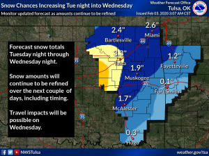
“The main show starts Tuesday night into Wednesday. As the storm system digs in through the Southern Plains before ejecting to the northeast, it could/should dump a goodly amount of snow along a swath from southwest to northeast somewhere in the Oklahoma/Texas vicinity. Not Houston, not Boise City, but somewhere in between,” he stated. “The forecast models are trying their darndest to come together and paint that heavy snow (4-6 inches, but I wouldn’t be shocked to see somewhere get 10+ inches) from northwest Texas up the I44 corridor right into central Oklahoma. Could shift 50 miles or some to the northwest or southeast, hence the broadened winter storm watch.”
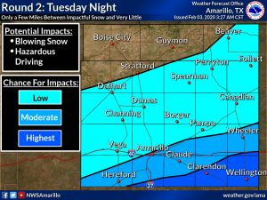
For those heading west on I-40, the drive could be difficult.
And the snowfall is predicted into eastern Oklahoma as well.
According to McManus, the cold weather gear will be a must.
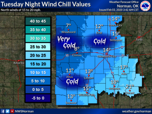
“Hmmmm, is Aunt Mabel still at your house for your Super Bowl party? Maybe get her to stay until Wednesday. NO, we kid, we kiiiiid. Just prepare now so you won’t have to get out and drive Wednesday, because not only could you have dangerous driving conditions, add to that bitter wind chills should you get stuck,” added McManus.
Source: Oklahoma Mesonet