


The U.S. Geological Survey announced that magnetic measures made during low-altitude airplane flights revealed possible deep faults might contribute to increased earthquake activity in Oklahoma and as a response to wastewater injection some parts of the state.
The flights were conducted for the USGS and the Oklahoma Geological Survey and were made from August through October of last year. The deep-imaging magnetic survey were recently published in Geophysical Research Letters.
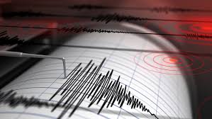
Oklahoma has been the site of thousands of earthquakes associated with wastewater injection activity, or induced seismicity, but few of the earthquake sequences have occurred on mapped faults, making seismic hazards difficult to estimate.
The USGS and the OGS used the newly acquired airborne magnetic data to image rocks where the earthquakes are occurring miles beneath the surface. The magnetic field maps reveal boundaries or contacts between different rock types, some of which are linear, similar to faults. A number of these types of contacts, (referred to as “lineaments” in the magnetic field map), are aligned with sequences of earthquakes. This suggests that some of them represent ancient faults that have been reactivated due to wastewater injection, which generates, or “induces” earthquakes.
“We are hoping the results will be used to guide more detailed studies at local scales to assess potential earthquake hazards,” said USGS scientist Anji Shah, lead author for the study.
Additionally, the data show that there is a dominant “grain” direction to the magnetic contacts (like wood grain) in the deep rocks where the earthquakes are occurring. This “grain” was formed hundreds of millions of years ago and may be composed in part by faults that are oriented favorably to move in response to natural background stresses within the earth. This alignment of deep features may contribute to the high levels of seismicity occurring in response to wastewater injection.
“There is nothing like a new data set to excite geoscientists looking for answers to some of the mysteries of induced seismicity in Oklahoma,” said Dr. Jeremy Boak, OGS Director. “We look forward to discussing these results among ourselves and with the interested technical community. We also hope to bring these data to bear on addressing the persistent seismic activity and sharing our interpretations with Oklahomans and other stakeholders regarding this challenging issue.”
Survey areas included parts of Alfalfa, Beckham, Comanche, Greer, Harmon, Kiowa, Jackson, Lincoln, Logan, Major, Noble, Pawnee, Payne, Pottawatomie, Stephens, Tillman, Woods and Woodward counties.
Other relevant findings of the USGS/OGS study:
Many of the possible deep faults highlighted by the magnetic data are different from those on previous fault maps. This discrepancy is probably because the previous maps reflect relatively young faults in the shallow rocks, whereas the magnetic data image the deeper, older rocks. The differences in the fault directions between these rock types are probably due to the different histories of ancient tectonic and magmatic events that shaped the rocks.
News 9 TV interviewed some of those involved in the study of seismic activity