A nasty potential ice storm is in the works and it could play a big role in affect Oklahoma’s energy industry in the coming days.
If the weather forecasters are accurate, central and northwest Oklahoma could see a major ice storm on Friday and Saturday. It already has the attention of electrical companies as they are preparing for outages and repairs.
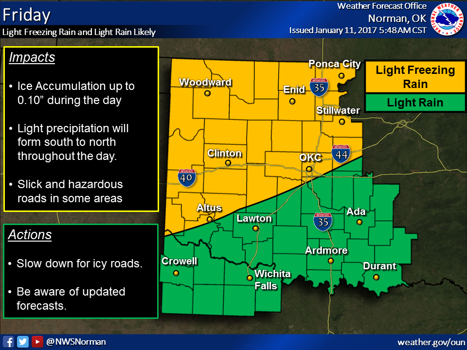
Gary McManus, State Climatologist with the Oklahoma Mesonet says exactly where the freezing line will fall in the state is the major question.
“The Oklahoma Mesonet is going to once again play one of the more significant roles throughout the weekend — locating that pesky freezing line. Wherever it sets up, to the northwest you have all sort of nasty trouble and to the southeast you have a whole lotta watah. And where will that fuzzy boundary be? I44, of course, the frequent Mason-Dixon line of weather in Oklahoma, famous thoroughfare for rushing tornadoes into the OKC metro area as well as…well, dividing ice and rain,” wrote McManus in his Wednesday Mesonet Ticker report.
His best advice? Watch the hourly temperature maps. They will offer the best clues.
“Our final takeaway? There is just too much uncertainty about this complex
storm setup for this weekend to give anything other than fuzzy answers. Some
things are less uncertain even through they’re shrouded in uncertainty. Let’s
say they’re accurate, but not precise.
* There will be problematic ice accumulations somewhere across northern OK.
* There will be a lot of precipitation with this system.
* The forecasts, while useful, will pale in comparison to “nowcasting.”
In other words, watch the forecasts and pay attention to them, but to really
be safe, especially across those fuzzy boundaries like the I44 corridor, you
have to keep up with the hour-to-hour weather.”