


What a big change in the weather is coming to Oklahoma. Record high temperatures are expected on Wednesday and Thursday before a cold front hits the state. Anyone working high atop an oil or gas rig will know it. So will those daring maintenance crews who stand atop wind towers across the state.
Here’s how News 9 meteorologist David Payne puts it: “WIND, TWO STORMS AND A FREEZE.”
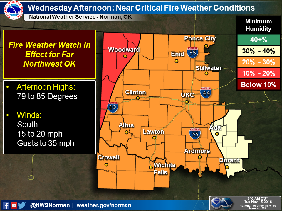
The real issue will be the wind starting on Wednesday.
“The wind cranks up Wednesday but especially Thursday and Friday. Fire threat will increase as well,” said Payne. “Much colder Friday and Saturday. Freezing temps. possible Saturday and Sunday a.m.” Then a second storm should arrive Monday and Tuesday.
State Climatologist Gary McManus with the Oklahoma Mesonet says Mother Nature will kick up the wind machine, creating a high fire danger on Wednesday and Thursday.
“And with the lack of moisture in the air (and the soils), lots of dormant/dead vegetation available for fuel thanks to a rainy spring and early summer and strong winds, fire danger will be on the increase for tomorrow and Thursday,” he wrote in Tuesday’s Mesonet report.
Plus, the drought is intensifying in the state, according to McManus who must have been singing that old song by the Doors when he came up with his warning, “Come on baby DON’T light that fire.”
Hear Jerry Bohnen’s interview of News 9 meteorologist Lacey Swope.